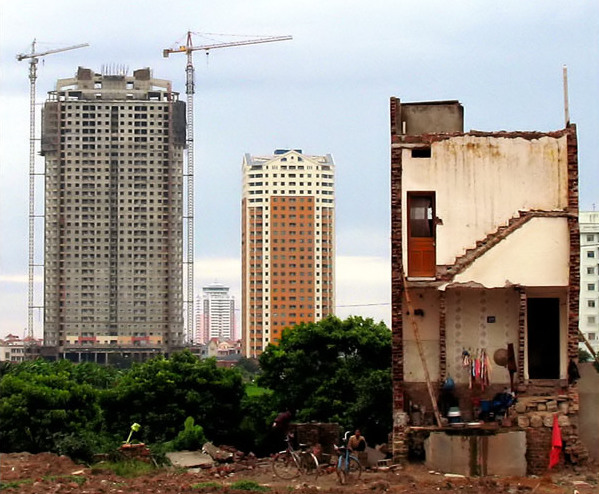
With a large population and limited availability of land, Vietnam’s endowment of 0.3 hectare of agricultural land per person is among the lowest in the world.1 Vietnam is historically a nation of small-scale rice farmers: the average farm size is 1,560 square meters, less than one-third that of Thailand or Cambodia.2 Rapid economic growth in the past two decades has converted up to one million hectares of household farmland to commercial and residential use.3 Land conversion has led to an increasing trend of land disputes4 and is a factor contributing to widening rural-urban disparities.5
Growing up #01 Hanoi. Photo by Duong Nguyen Hoang, Flickr (cropped), taken 24 November 2006. Licensed under CC BY-NC-ND 2.0.
Land policy and administration
Vietnam’s Constitution holds that land and other natural resources are “public property, owned by all the people, and represented and uniformly managed by the State.”6 In Vietnam’s single-party political system, overall direction for land policies is set by the Communist Party’s Political Bureau (Politburo). The Ministry of Environment and Natural Resources (MONRE) is the primary government agency responsible for developing and implementing land policy. The National Assembly approves draft laws and monitors their implementation. Additional oversight roles are given to the ruling party, the Vietnam Fatherland Front,7 and the Vietnam Union of Science and Technology Associations (VUSTA),8 the latter a socio-professional umbrella organization that registers many Vietnamese NGOs.9
Vietnam’s current Land Law was issued in 2013.10 Following passage of the revised law, MONRE issued a series of sub-law decrees covering implementation guidance, compensation, resettlement, and land pricing.11 Some key features of the 2013 Land Law include:
- Decentralization of many important administrative functions, including land pricing and land use planning, to provincial and district levels. Provinces set land prices through appraisal boards headed by the provincial governor (chair of the People’s Committee) (Article 114).
- Ethnic minorities are given priority in land allocation (Article 133).
- Citizens and mass organizations are given limited monitoring roles in land use planning (Article 43), land use conversion (Article 69), and land management (Articles 198-199).
Research on transparency of land information concludes that there were many improvements in the government’s provision of information from 2010-14, but that overall transparency still falls short of legal requirements and full access to information.12 It remains the case that one of the main issues impacting land governance in Vietnam is the gap between law and practice.13 This disproportionately impacts smallholders.14
Civil society interest in land policy issues has increased in recent years. Three land-related networks are currently active: the Land Alliance (Landa), Forest Peoples Land Rights Network (LandNet), and Forest Land Coalition (Forland).
Land classifications and tenure rights
As of the end of 2013, 81 percent of Vietnam’s total land area of 33 million hectares was classified by the government as agricultural land, including cropland (35 percent), forest land (45 percent), and aquaculture (1 percent).15 3.8 million ha (about 35 percent of all cropland) is legally reserved for rice cultivation only,16 although the area of rice land has decreased slightly since 2011.17 The government’s priorities for land use from 2016-2020 emphasize infrastructure construction, industrialization, and urban expansion. Farmers whose land is threatened by drought, salinization, and climate change will be given permission to transfer land to other agricultural purposes.18 Such environmental effects, which are also linked to dam construction and deforestation, are increasingly affecting coastal agricultural land, including over 970,000 ha in the Mekong Delta.19
The State allocates or leases land to individuals and organizations through issuance of Land Use Right Certificates (LURCs).20 LURCs may be exchanged, transferred, mortgaged, leased, and inherited. Varying rights are granted for different types of land. Residential land is allocated for indefinite terms; agricultural LURCs (“red books”) and forest land for 50-year terms.21 Farmers cannot convert agricultural land to other uses without state permission.22 Forest users’ rights to use allocated land are the most restricted, especially on harvesting timber.
| Term | Description |
|---|---|
| Forest area | Forest is determined both by the presence of trees and the absence of other predominant land uses. The trees should reach a minimum height of 5 meters in situ. Areas under reforestation that have not yet reached but are expected to reach a canopy cover of 10 percent and a tree height of 5 meters are included, as are temporarily unstocked areas, resulting from human intervention or natural causes, which are expected to regenerate. |
| Permanent cropland | Land cultivated with crops that occupy the land for long periods and need not be replanted after each harvest, such as cocoa, coffee, and rubber. This category includes land under flowering shrubs, fruit trees, nut trees, and vines, but excludes land under trees grown for wood or timber. |
| Arable land | Includes land defined by the FAO as land under temporary crops (double-cropped areas are counted once), temporary meadows for mowing or for pasture, land under market or kitchen gardens, and land temporarily fallow. Land abandoned as a result of shifting cultivation is excluded. Data for “Arable land” are not meant to indicate the amount of land that is potentially cultivable. |
Vietnamese law does not recognize customary forms of tenure, and communities (villages) do not have legal status to engage in land transactions. This is inconsistent with customary practices of many ethnic groups, who perceive land (especially forests) as belonging to an entire village. The Law on Forest Protection and Development (2004) does allow for community management of forest land.23 However, actual implementation has been limited: as of 2015, only 2 percent of forest land had been allocated to communities, compared with 26 percent to individuals; the remainder is held either by state enterprises, management boards, or local authorities.24
Issuance of LURCs has proceeded quickly in some areas of the country, slowly in others. The initial land titling program of the government in the 1990s was one of the largest and most rapid such efforts in the world.25 As of 2013, 38 million certificates had been issued, with at least 11 southern provinces close to full coverage and many others below 70 percent completion.26. By the end of 2015, the World Bank and other international donors have implemented several packages to assist Vietnam in promoting the issuance of LURCs.27

A tree farm nursery in Quang Ninh, Vietnam. Photo by Jeff Warren, Flickr, taken 19 January 2009. Licensed under CC BY-SA 2.0.
Women face disparities in access to land, particularly through patrilineal inheritance customs.28 Up to 2012, only 36 percent of agricultural LURCs were held jointly or in women‘s names for the Kinh majority, and an even smaller 21 percent for ethnic minority women.
Vietnam’s massive contamination by landmines and unexploded ordnance has been partially addressed through intensive efforts of the armed forces and international demining support. The central provinces around the former demilitarized zone (DMZ) and certain border areas remain the most affected.29 Dioxin-based herbicides such as Agent Orange were sprayed over more than 2.2 million ha of land in South Vietnam during the Vietnam War, leading to health and localized environmental effects, but leaving no long-term soil contamination.30
Land transfer and public land lease
The 2013 Constitution and Land Law permit the state to recover allocated land through a process of compulsory land acquisition. Such expropriation must be based on a national defense or security purpose or “in the national or public interest”.31 This is narrower than pre-2013 law, which allowed land acquisition for economic development purposes.32 An estimated 10 percent of the population has been affected by expropriation, but there are initial signs that the revised law has reduced the incidence of new cases.33 Expropriation in the last 20 years has primarily targeted agricultural land.34
Source: UNIDO. Created by ODI June 2016. Licensed under CC BY-SA 4.0. Explore the data.
By May 2017, Vietnam has 325 economic zones used for export industrial production, including industrial parks and Special Economic Zones (SEZs)35. There are few cases of large agricultural concessions granted to foreign investors;36 instead, state enterprises keep a leading role in the economy and manage over 2.8 million ha of agricultural and forestland.37
Land dispute resolution
MONRE and the National Assembly keep annual records of complaints and petitions sent by citizens. Land disputes comprise the vast majority of all complaints: 98 percent of those sent to MONRE in 2014.38 Of one million complaints submitted from 2003-2012, the National Assembly reported that “only around half…were correctly, or partially correctly, handled”, mostly through being sent back to lower levels of government39 (who have primary responsibility for responding, according to the Law on Complaints).40 Local governments are generally able to resolve disputes between citizens, but not those between citizens and government agencies.41
Affected citizens typically press land dispute cases through official channels to higher levels first. If such petitions do not lead to satisfactory outcomes, they may turn to the media or public actions, such as demonstrations in front of government offices in Hanoi, Ho Chi Minh City, and other provincial centers. Security forces allow some protests to continue, but sometimes intervene with force if disputes become widespread or to conduct immediate land clearance.42 Among the most prominent land conflicts in recent years were the Doan Van Vuon expropriation case in Tien Lang district, Haiphong43 and construction of the Ecopark new urban area outside Hanoi 44 or in Dong Tam village, Hanoi. 45. Most land conflicts are caused by improper procedures of land acquisition, low levels of compensation, and/or perceived corruption.46 Few disputes are adjudicated in the courts;47 instead, the print and online media play a de facto accountability role in holding some government and business land users to account.
Open Development Initiative is currently seeking partners to manage Open Development Vietnam. For more information, please get in touch at partnerships@opendevmekong.net.
References
- 1. USAID. Country profile: Property rights and resource governance, 2013, page 5. Dang Hung Vo and Nguyen Van Thang. Improving land governance in Vietnam, draft report, 2013, page 8. Land Governance Assessment Framework.
- 2. Centre for Agricultural Policy. Vietnam Farmers’ Union, Vietnam Chamber of Commerce and Industry (VCCI), and Advancement of Community Empowerment and Partnership (ACEP). Land consolidation for poor people in Vietnam, report summary. 2013.
- 3. Embassy of Denmark, World Bank and Embassy of Sweden. Recognizing and reducing corruption risks in land management in Vietnam, 2011, page ix.
- 4. A Wells-Dang, Pham Quang Tu and A Burke. “Conversion of Land Use in Vietnam through a Political Economy Lens”, Vietnam Journal of Social Sciences and Humanities 2:2 (April 2016).
- 5. World Bank. Taking stock: An update on Vietnam’s recent economic developments. 2014.
- 6. Constitution of the Socialist Republic of Vietnam (2013), Article 53.
- 7. Law on the Vietnam Fatherland Front, #75/2015/QH13, Articles 25-27, 32.
- 8. Prime Ministerial Decision #22/2002/QĐ-TTg, dated 30 January 2002.
- 9. Ibid
- 10. Law #45/2013/QH13 (Land Law), passed 29 November 2013.
- 11. Government Decree 43/2014/NĐ-CP guiding implementation of the 2013 Land Law, Decree 44/2014/NĐ-CP on land pricing, and Decree 47/2014/NĐ-CP on compensation, support, and resettlement.
- 12. World Bank and DEPOCEN. Land transparency study synthesis report, 2014, pages 12-13.
- 13. Micah L. Ingalls, et al. 2018. State of Land in the Mekong Region. Accessed March 20, 2019.
- 14. Micah L. Ingalls, et al. 2018. State of Land in the Mekong Region. Accessed March 20, 2019.
- 15. Ministry of Natural Resources and Environment, Decision 1467/QD-BTNMT, issued 21 July 2014.
- 16. JA Giesecke, NH Tran, EL Corong and S Jaffee. “Rice land designation policy in Vietnam and the implications of policy reform for food security and economic welfare.” Journal of Development Studies 49:9 (2013), pages 1202-1218.
- 17. Government of Vietnam, Report #46/TTr-CP on the adjustment of national land use planning, 2016-2020 , submitted to the National Assembly 27 February 2016, page 5.
- 18. Ibid, pages 10-11.
- 19. Tuoi Tre News. “Vietnam’s Mekong Delta faces most serious drought, salinization in 90 years”, 18 February 2016
- 20. Constitution of the Socialist Republic of Vietnam (2013), Article 54(2).
- 21. Land Law 2013, Article 126.
- 22. Land Law 2013, Articles 57, 134.
- 23. Forest Law #29/2004/QH11, Articles 29-30.
- 24. A Wells-Dang, Pham Quang Tu and Ngo Van Hong. “Reform of State-owned forest enterprises and ethnic minority land tenure security in Vietnam.” Paper presented at the World Bank Conference on Land and Poverty, Washington DC, 14-18 March 2016.
- 25. L Iyer and Q-T Do. “Land titling and rural transition in Vietnam.” Economic Development and Cultural Change, 56:3, April 2008.
- 26. Vietnam News Service. “Land-use certification to be sped up”, 5 March 2013; “Deadline set for land-use certificates”, 12 August 2013/ref] The World Bank and other international donors have supported land titling programs in the past, the last of which ended in 2015.48The World Bank’s Land Administration Project (2008-15) supported issuance of 1.8 million LURCs, 1.6 million of them to women
- 27. According to the report of the World Bank’s Land Management Project in Vietnam
- 28. TN Tran, Hoang Cam, Le Thanh Sang, Nguyen Thi Phuong Cham, Ngo Thi Phuong Lan and Vu Thanh Long. The exclusion of women’s access to land in contemporary Viet Nam. 2012. United Nations Development Program.
- 29. Landmine and Cluster Munition Monitor. Vietnam: Mine action, 29 November 2015
- 30. War Legacies Project, The invisible enemy. 2010
- 31. Constitution, Article 54(3); Land Law 2013, Article 62.
- 32. Land Law #13-2003-QH11, Article 38(1).
- 33. CECODES, Viet Nam Fatherland Front and UNDP. The Viet Nam Provincial Governance and Public Administration Performance Index (PAPI) 2014: Measuring citizens’ experiences, pages 14-15.
- 34. Micah L. Ingalls, et al. 2018. State of Land in the Mekong Region. Accessed March 20, 2019.
- 35. UNIDO, Economic zones in Vietnam provinces, accessed May 2017
- 36. For an analysis of one case of agribusiness expansion, see Oxfam, “Strengthen community voices for informed choices: Land-use and land-use change in central Vietnam.” 2012.
- 37. Government of Vietnam, Government Report #70 to the Politburo on implementation of laws and policies on management and land use of state farms and forest enterprises (2004-14), 9 March 2015.
- 38. Dang Linh, 70% of complaints and denunciations relate to land, 31 March 2015
- 39. Tuoi Tre News. Land should be priced by independent rating entity: Expert, 24 September 2012
- 40. Law on Complaints#02/2011/QH13
- 41. Asia Foundation. The mechanism to settle administrative complaints in Vietnam: Challenges and solutions. 2009.
- 42. Benjamin J Tria Kerkvliet. “Protests over land in Vietnam: Rightful resistance and more.” Journal of Vietnamese Studies, 9:3 (Summer 2014), pages 19-54.
- 43. Kaitlin Hansen. “Land law, land rights, and land reform in Vietnam: A deeper look into ‘land grabbing’ for public and private development.” 2013. SIT Graduate Institute, independent study project report.
- 44. Reuters. “Vietnam detains 20 in latest land clash – media,” 25 April 2012.
- 45. Vietnamnet, article series about Đồng Tâm
- 46. Embassy of Denmark, World Bank and Embassy of Sweden. Recognizing and reducing corruption risks in land management in Vietnam. 2011.
- 47. Asia Foundation. The mechanism to settle administrative complaints in Vietnam: Challenges and solutions, 2009, page 18.

